Thursday 8th October 2020
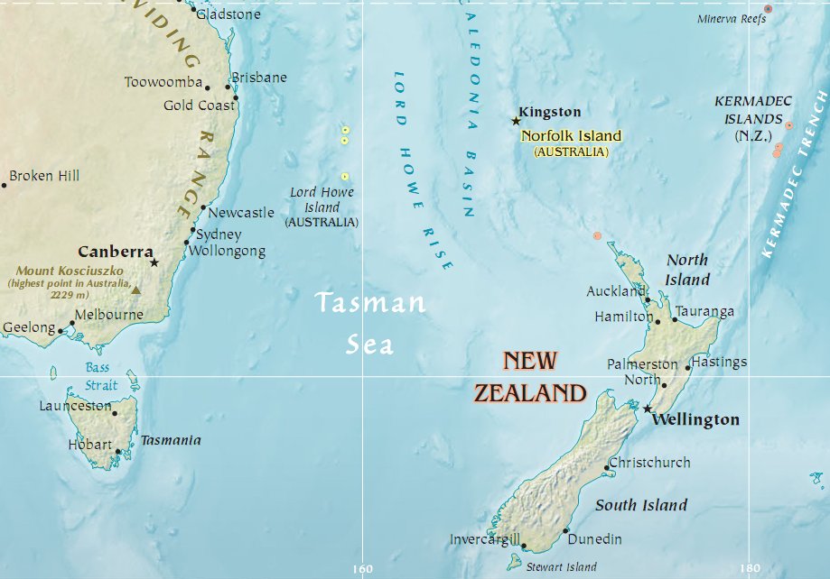
In the South Pacific exists a tiny island, Lord Howe Island, which is 10 km long and 2km wide and belongs to New South Wales, Australia. It is located 600km directly east of Port Macquarie, 780 km northeast of Sydney and 900 km southwest of Norfolk Island and that’s where we decided to go for a short week for some hiking and freediving with my friend Silvia in early October. It went into lockdown on 22nd March until 2nd October because of covid-19 so it was really awesome to be part of the first people able to go as soon as it reopened.
Here is a map showing where it is located in the Tasman Sea.
The first reported sighting of the island took place on 17th February 1788, when Lieutenant Henry Lidgbird Ball, commander of the armed tender HMS ‘Supply’ was en route from Botany Bay to found a penal settlement on Norfolk Island with 15 convicts. It apparently was never known to the Polynesians people of the South Pacific and never inhabited before its discovery in 1788.
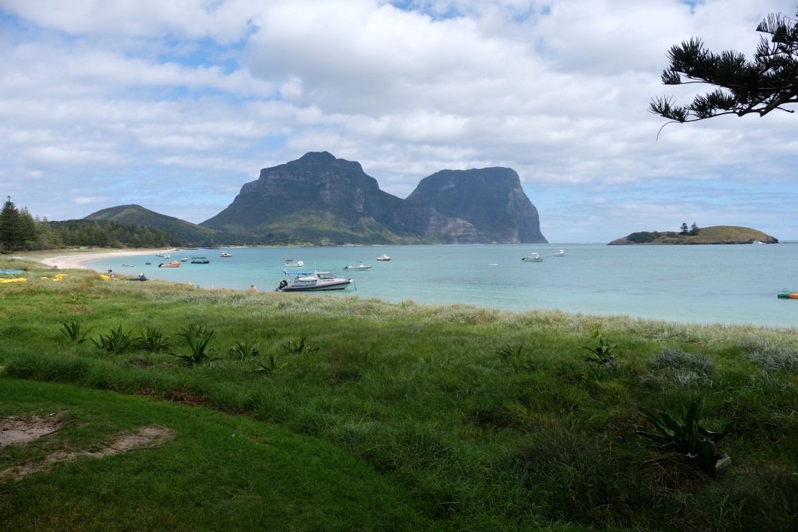
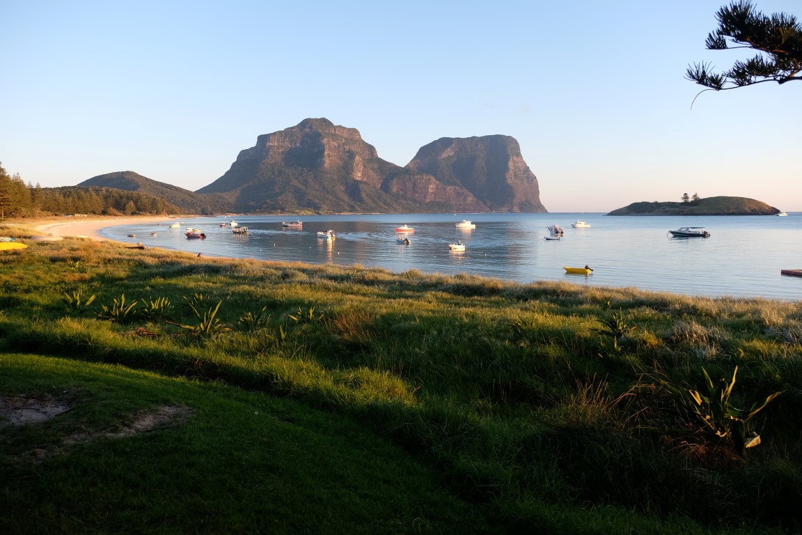
Seeing the island and two mountains from far, Lidgbird actually thought there were two islands. On the return journey, he realised it was one main island, sent a party ashore on it to claim it as a British possession and named the island after Lord Howe, who was the first lord of the Admiralty at the time. Would it have been a few months later and the island could have been named Lord Chatham Island, after the first lord of the Admiralty who took over from Lord Howe…Lidgbird also named the rock formation which stands 23 km away from the main island after himself as Ball’s Pyramid and named one of the two mountains after himself too, Mt Lidgbird, which culminates at 777m high. He named the highest one which culminates at 875m as Mt Gower, after John Leveson Gower, who was also a lord of the Admiralty at the time. More info can be found about Gower here: http://www.berkshirehistory.com/bios/jlevesongower.html
He also named the 7 small islets which are near Ned’s Beach as the Admiralty Islands. In total, Lord Howe Island is a grouping of 28 islands of various sizes.
Lord Howe Island subsequently became a provisioning port for the whaling industry and was permanently settled in June 1834. When whaling declined, the 1880s saw the beginning of the worldwide export of the endemic kentia palms which remains a key component of the island’s economy. The other continuing industry, tourism, began after World War II ended in 1945.
Information extracted from Wikipedia: https://en.wikipedia.org/wiki/Lord_Howe_Island
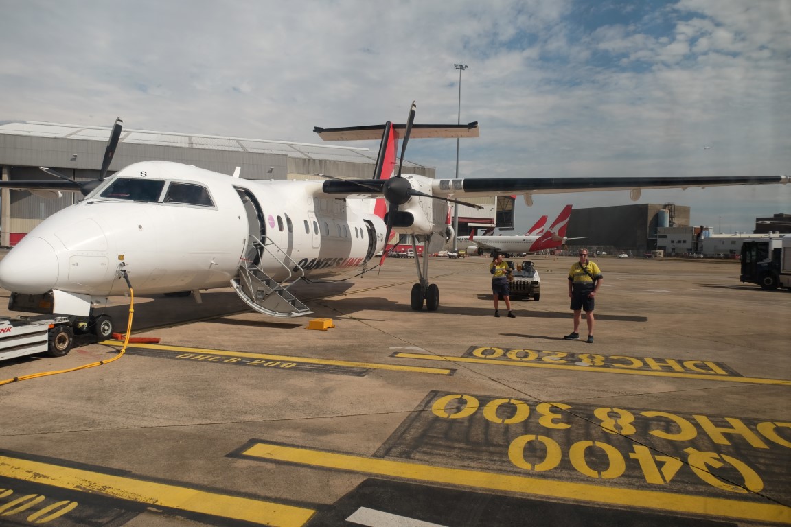
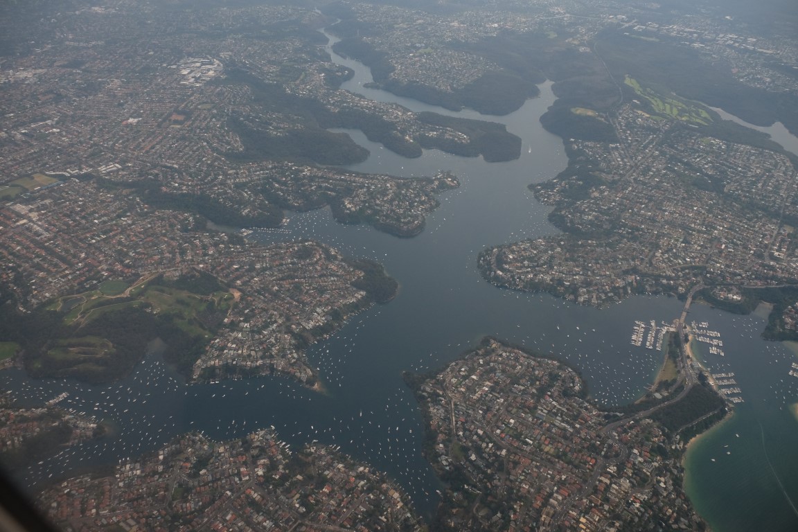
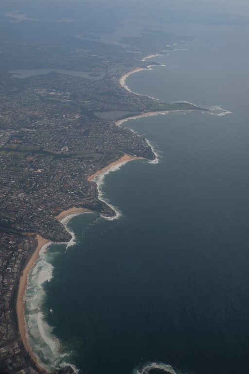
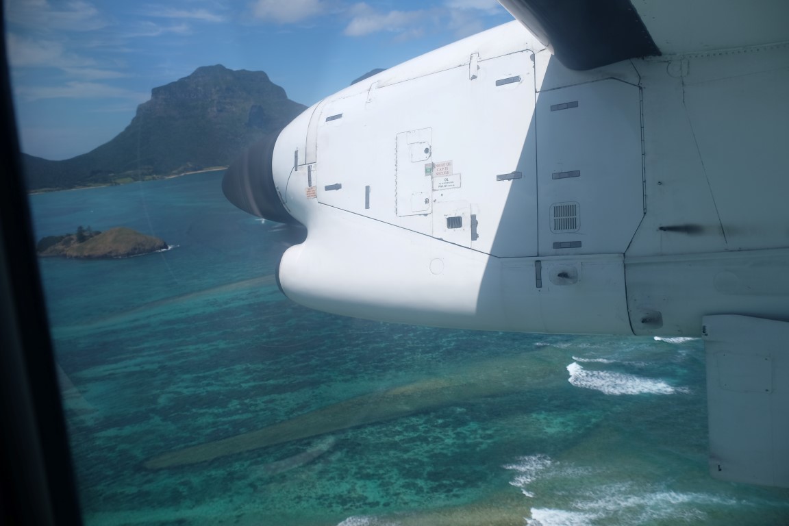
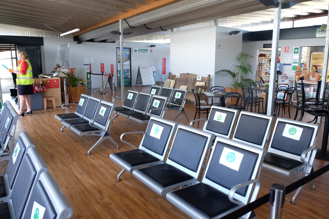
We boarded the 10.50 am flight on the Dash 8-200 QantasLink plane which has a capacity of 30 seats but only had 15 passengers that day, which is very rare for planes going to Lord Howe Island as they are usually full so it was only the case because it had just reopened. Only 400 tourists are allowed on the island at any one time and there are around 380 inhabitants. We wore our P2 masks on the flight as all passengers and flew in 2 hours across the ocean to Lord Howe Island, leaving crowded Sydney, passing above the Northern Beaches, across the ocean and arriving above the beautiful lagoon before to land.

The airport was only built in 1974. The first flights started in 1947 on 4-engine Sandringham flying boats operated by Ansett out of Rose Bay. They took 3h30 to cross and landed in the lagoon. Here are some pictures extracted from an old tourist brochure I had picked up from a charity shop which has no date and no photographer credit sadly.
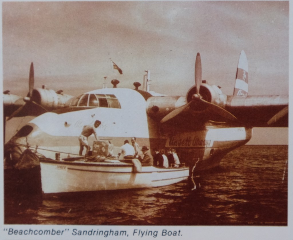
The people arriving would be carried on shore by boat and then sometimes to the beach on the shoulders of the locals so they wouldn’t wet their feet.

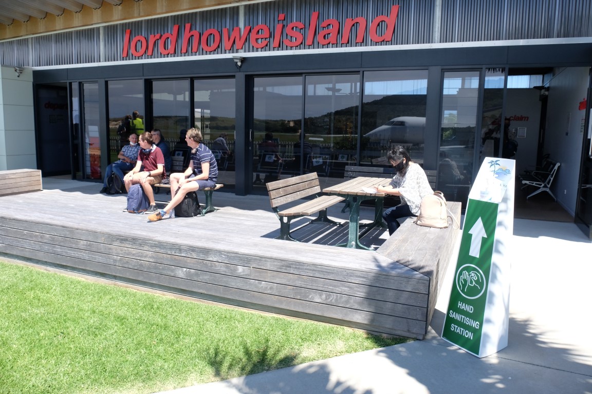
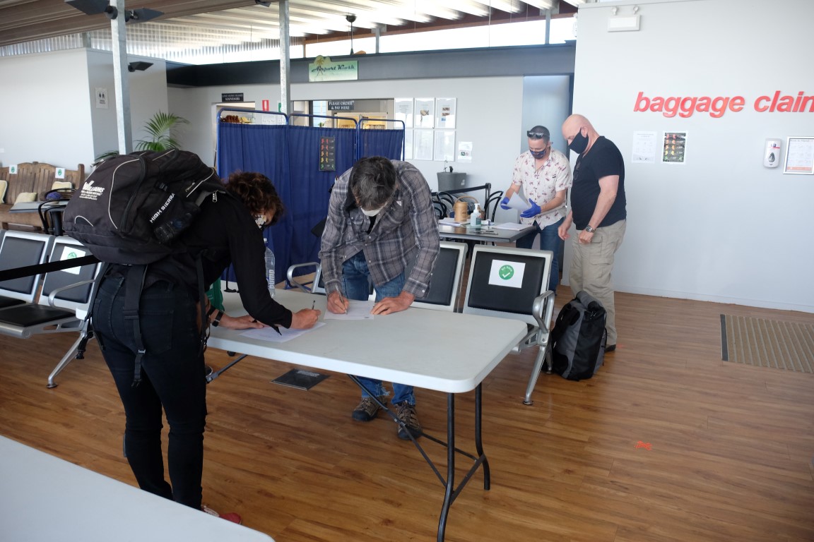
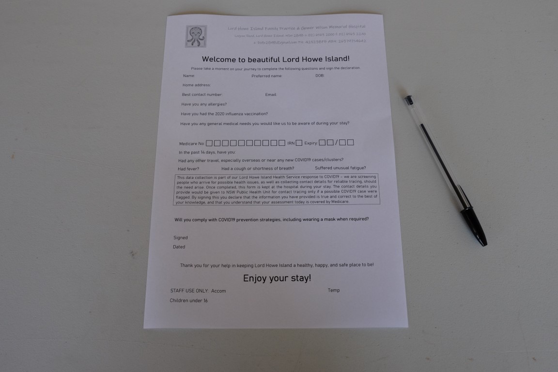
As for us, we landed on the tarmac. We went through the covid-19 protocol, providing Medicare details and signing a form confirming we had no symptoms. It was the first time we were back on a plane since March when Australia had shut down because of covid-19 and it is strange to think that the way we now travel has changed so much and might not go back to the way it was for a few years, if it even ever does.
We were picked up by Rebecca, the property manager of Somerset Apartments where we were staying and were driven in 5 minutes to it, the advantage of such a small island being that distances are really short.
We had read that food could be really expensive on the island so we had brought heaps of food, cheese, salamis, wraps, tuna cans, pasta, rice and lentils, crackers and dips. Although we ended up finding out that prices were not that bad, the main advantages of bringing our own food was also to save time not having to go shopping for food and not being dependent on restaurants or grocery stores opening hours, especially on the first day.
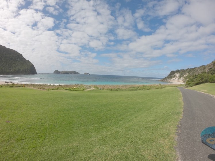
So we unpacked a bit, had our lunch snack, and then grabbed our freediving gear and headed to Ned’s beach.
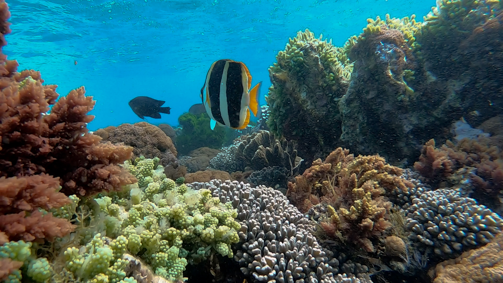
Lord Howe Island is encircled by the world’s southern-most coral reef and was inscribed on the UNESCO World Heritage List in 1982. It is at the cross-road of five major ocean currents including the warm East Australian Current which runs down the Great Barrier Reef and down into the Tasman Sea. This abundant and diverse mix of tropical, sub-tropical and temperate species is found nowhere else on earth: there are over 90 species of coral and 500 species of fish inhabiting the reef making this an incredibly interesting place to visit and dive.
Extract from: https://www.originaldiving.com/australasia-pacific-islands/australia/dive-lord-howe-island
While researching information about Lord Howe Island, I came across this document which explains the story behind all the names of the island: https://www.anps.org.au/upload/ANPS%20Placenames%20Report%203.pdf
Here is an extract explaining the name of Ned’s beach:
In July 1844, Dr John Foulis arrived on the passenger schooner Wave. During the landing,
one of the boats belonging to the settlement was dashed to pieces against rocks and three
crewmen of the Wave lost their lives. The first body recovered, believed to be a man named
Ned, was buried in the sands of the bay where the accident occurred. Neds Beach was
reputedly named after this incident although many of the older Islanders dispute it,
claiming it was named after the ex-whaler Ned Ambrim, who had a garden in that area.
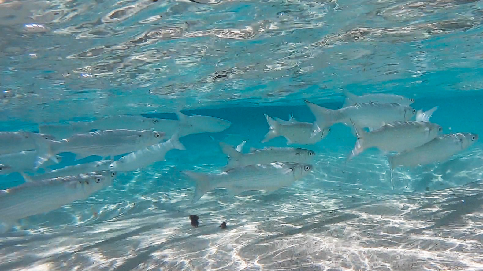
After the cold 17-degree water of Sydney coastline and generally poor visibility we were used to, it was heaven for Silvia and I to freedive in 20-degree water, 30-meter visibility and see such a beautiful and rich coral reef. In the past 5 years, I have got to see many broken and bleached or dying coral in Philippines, Indonesia, Maldives, Great Barrier Reef, Hawaii and French Polynesia, so I have now got to appreciate a beautiful coral reef, more than I used to, when I see one which is still intact and still thriving. It is sad to say that I do not look at it with the same naive eyes either as if it was a coral that would permanently stay like that, but I rather look at it now with a darker look as one of the last remnants that will probably sadly soon disappear or get damaged within the next 50 years or less, unless we find ways to save it, which I hope we do.
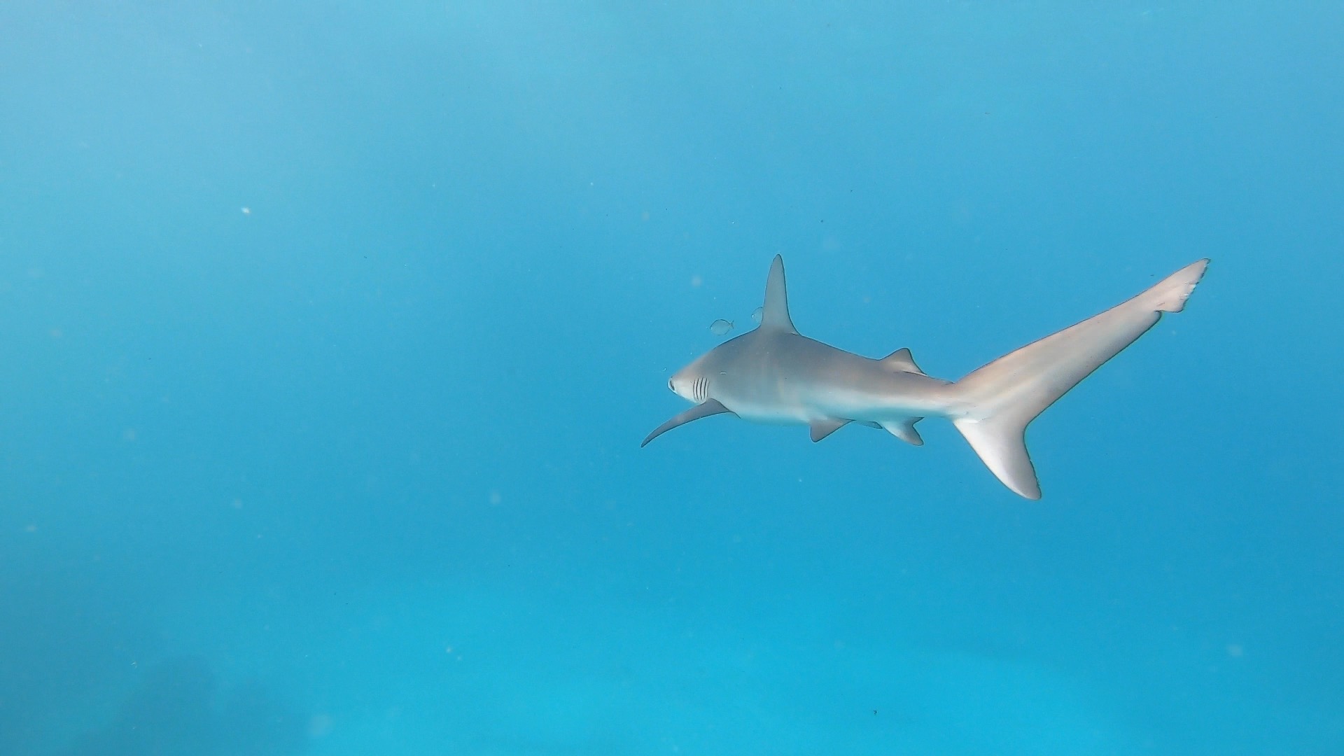
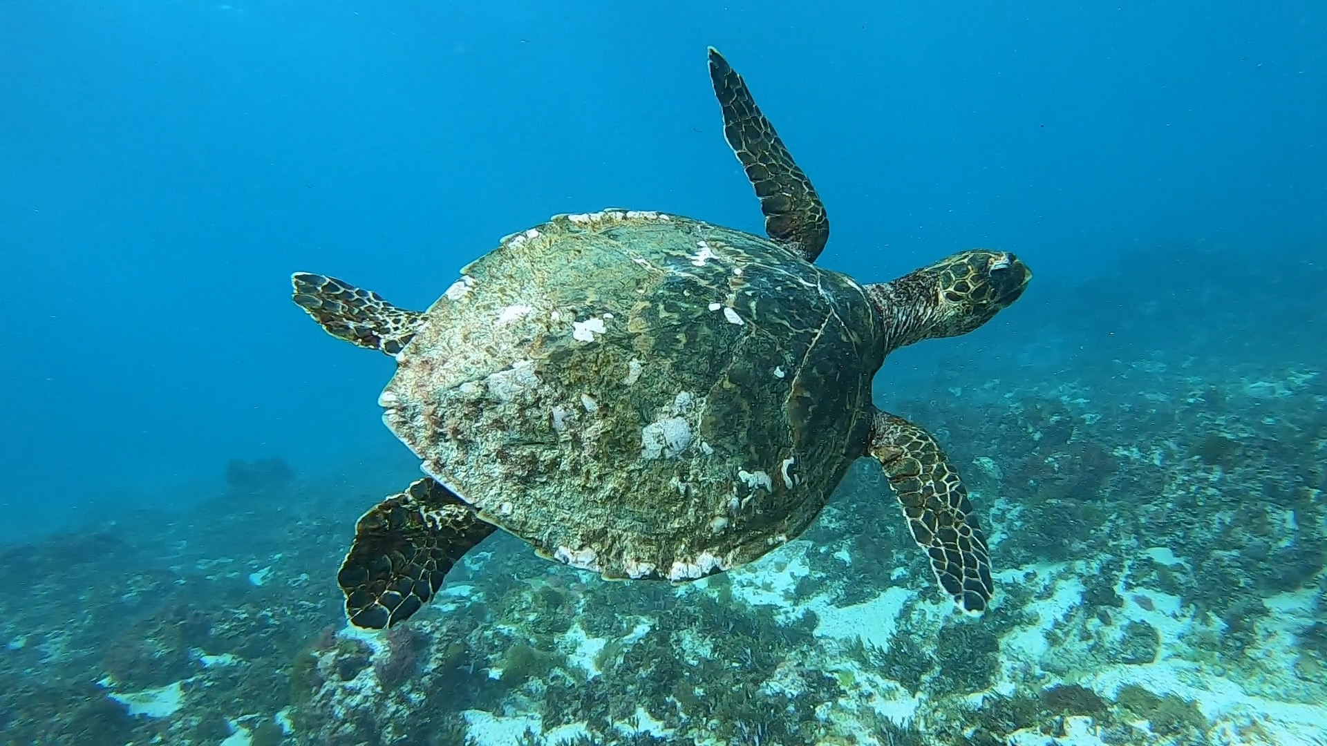
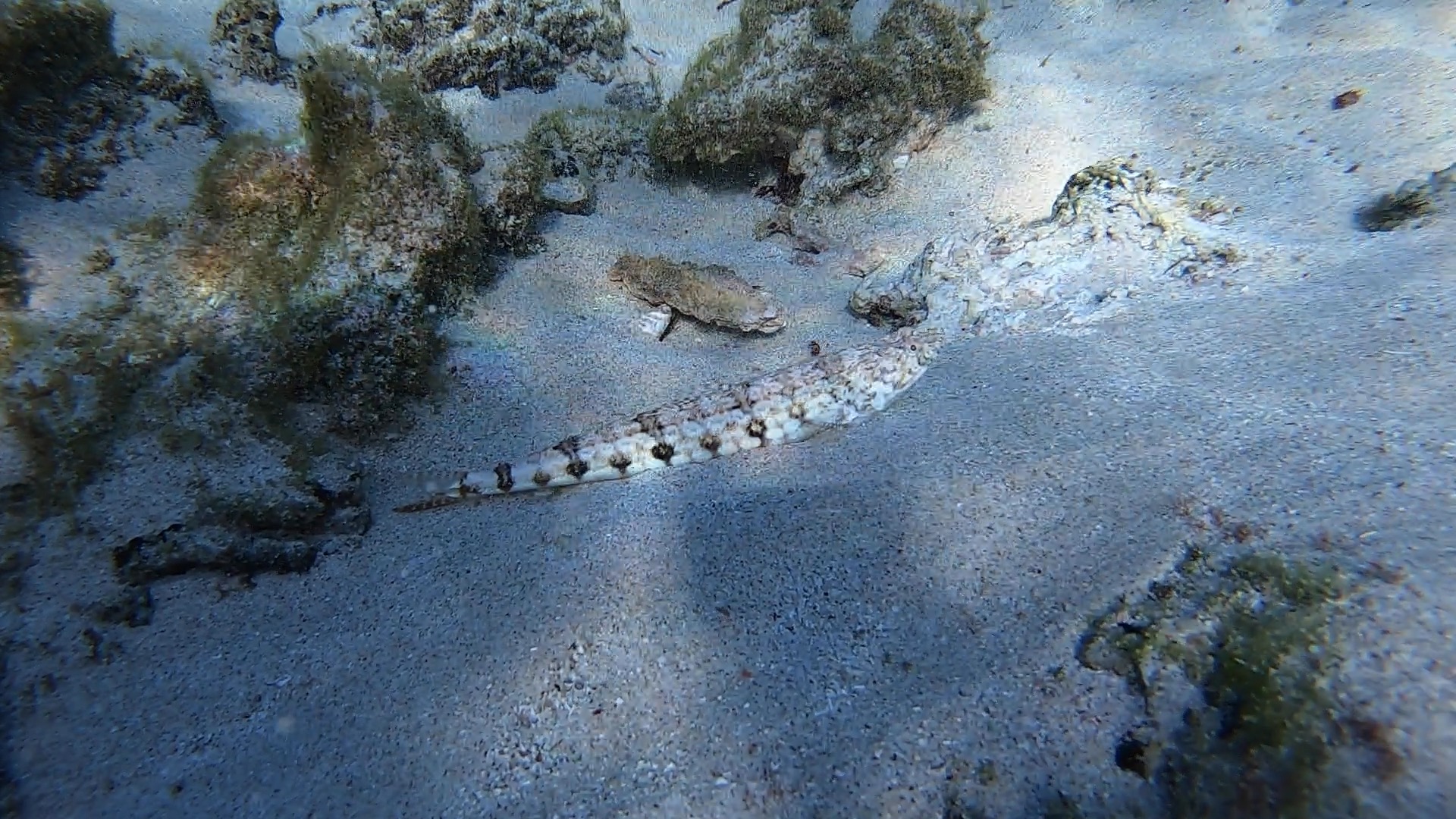
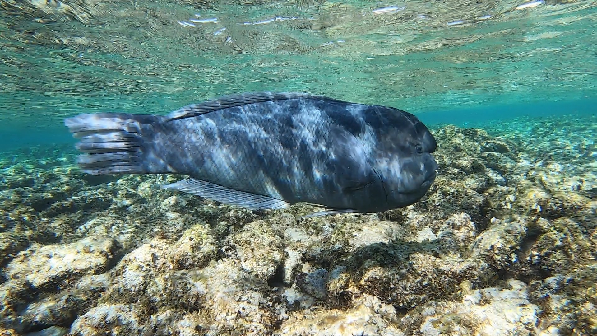
Besides seeing an incredible and diverse coral reef, we were lucky to see Galapagos sharks and hawksbill turtles during our first freedive, as well as the funny grumpy bookfish, and the inquisitive photo-bomber double-header fish. The Galapagos shark is found worldwide and favors clear reef environments around oceanic islands and can grow to 3m. It is no danger to the human and beautiful to observe and swim with, although it is really shy. It was exciting for us to swim with them as Lord Howe Island is the only location within Australian waters where they are known to occur. More info about them here: https://www.marine.nsw.gov.au/knowledge-centre/latest-news/tagged-sharks-on-the-move-at-lord-howe-island
Here are some extracts from the go pro videos I took:


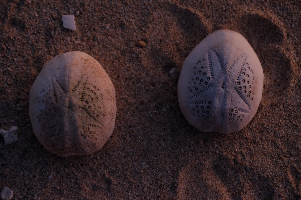
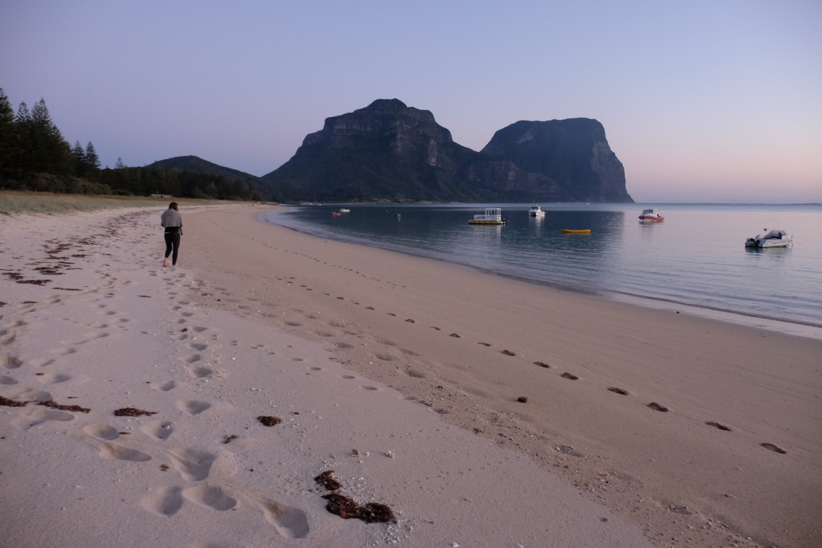
After our freedive, we went to the lagoon side and enjoyed a walk on the beach. We discovered the shells of the iconic heart urchin while walking on the beach and enjoyed the beautiful sunset over the sea, which we never get to the see on the East coast of Australia. We truly felt far away on an exotic tropical island, and yet we were only a 2-hour flight away.


Here is the map we were given on arrival, showing the west part of the island and on which I added where we went that day and the next days. Day 1 in black was our arrival at the airport, picked up and dropped at Somerset Apartments (number 16) and shows where Ned’s Beach here, 5 minutes walk from where we stayed.
Lagoon Beach is where we went in the evening.

Next day, hike around the Western part and freedive at Lagoon Beach!
