Saturday 2nd November 2013
Here is a map of what we did that day. From Frasers at Cathedral Beach, up North to Indian Head.
Then down to Lake Wabby, then down almost to Dilli Village then up a bit again to Eurong.
After a good breakfast, we left Cathedrals on Fraser, and drove north. The weather was a bit foggy.

We stopped a bit to contemplate the Red Canyon.
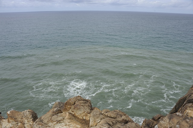
Then we got closer to Indian Head. The sea was a bit agitated and producing a lot of foam.
When we arrived at Indian Head, we took a sandy track and within a few minutes we were on its other side. We drove on the beach to Champagne Pools. We took the boardwalk to get to the pools, a boardwalk called “the rocky headland imagine walk”. Here was the view to the right, towards Indian Head we had just left.
We got to the Champagne Pools but it was a bit disappointing, as they were full of sand.
Here is a picture from internet of how they are supposed to look when you are lucky!
On the left, we could see the next beach going to Waddy Point.
The tip of Fraser Island looked really interesting. It made me want to come back for longer one day to discover Marloo Bay and Platypus Bay!
Although we couldn’t swim in the Pools, we hanged around for a bit. There were Mummy Starfish and Baby Starfish having a swim.
We saw some mini Ninja turtles sticking to the rocks.
And some other shells.
We also some pipis which were spitting some water from time to time. They are called pouce-pieds in French . The literal meaning being thumb-foot. Maybe because it looks like a thumb but is under your foot?
On the way back to the beach after Indian Head, a 4WD got bogged down. Some people were pushing, and trying to dig it out of the sand. Most people were just observing.
Another 4WD arrived and managed to pull it out with a rope and the car could start again on more solid ground and made it through.
On the other side, we headed up the hill to see the view point, and couldn’t avoid a big bus of tourists going up at the same time.
The view from the top towards Champagne Pools was pretty nice.
A bit more to climb..
And everyone started to contemplate the view from the top.
Here was the view. We were all trying to spot some whales but it was already late in the season and we didn’t see any, neither sharks or manta rays or dolphins.
So we headed back and started driving south. We stopped near a campground and prepared some lunch at the tables. There was a mini exhibition about Aboriginals there where we learned more about the Badtjala, the traditional Aboriginal tribe which was living on Fraser Island since thousands of years.
While eating lunch, I got bitten by some ants. It was really painful. I wonder if it was fire ants. I was in pain for the next few hours. Luckily we had in the esky some small bottle water still half-full of ice which proved to be really handy. I just carried that bottle against my leg in my pant for the next few hours.
On the way south, we spotted another dingo, a young one this time.
We saw again the Maheno wreck. It looked really mysterious from far in the fog.
It still impressed me and I found it even wider than the day before. It’s a really fascinating wreck as you can approach it from so many various angles.
We kept driving and saw some fishermen.
We parked the car at the entrance of the walk to the Lake Wabby. It took us about 1h30 to get to the lake. The path was quite sandy.
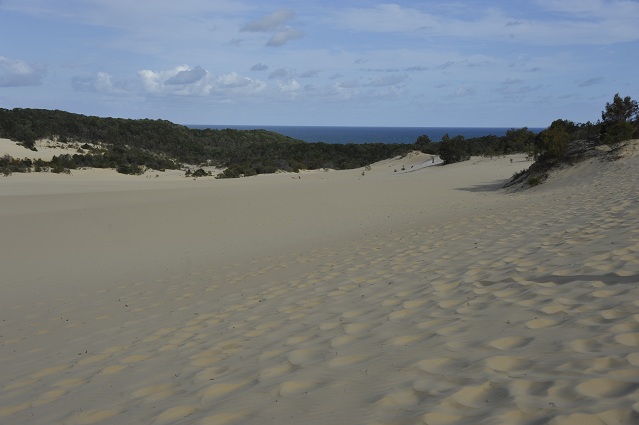
At the top, there were a really long stretch of sand. It did look a bit like being in a desert. We could see the sea in the horizon.
We kept walking left. This sand stretch was really fascinating.
We got to Lake Wabby. It’s the deepest lake of Fraser Island but it’s currently slowly being engulfed by a massive sandblow.
We walked back to the car. It was already 5pm and the tide was 1h30 away from high tide. We drove in the direction of Dili Village where we had planned to sleep for the night but a bit before to get there, there was a creek deeper than what we wanted to cross. We could have tried, but the more minutes passed, the higher the tide was getting. It was a bit frustrating to not make it, but we decided to play it safe, and turned back, in the direction of Eurong.
On the way back to Eurong, we saw two young dingos, one carrying a dead mutton bird in its jaws.
We also saw another dingo after, seemed to be a female one.
We had also thought about taking the inner pass from Eurong to Dili Village, but the night was falling and driving in the sand at night didn’t seem safe either. So we played it safe here too and stayed at the Eurong resort. We would have preferred tents, instead of concrete. Concrete didn’t give an “island feel” to the night. But the compensation was the big swimming pool they had and we made a point of going into it the next day.
Here we were on Fraser, at Eurong for our second night!


