Thursday 25th January 2018
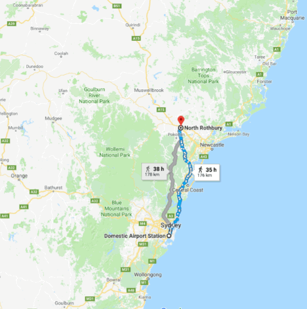
We picked up a car around 7pm at Redspot at the Domestic airport for a 3-day rental and headed to a brand new city called Huntlee (Hunter Valley shortened -> Huntlee) next to Singleton where we had booked an airbnb. It took us 3 hours to get there with the Australia Day long week-end traffic slowing us down a bit. Here was the drive we took:
In Huntlee, we met Ben who hosted us and showed us around and with who we had a lengthy chat about real estate prices in Australia, put some kiri cheese in the fridge, had showers, repacked the bags so they would be ready for a quick packing in the morning and went to bed.
Friday 26th January 2018
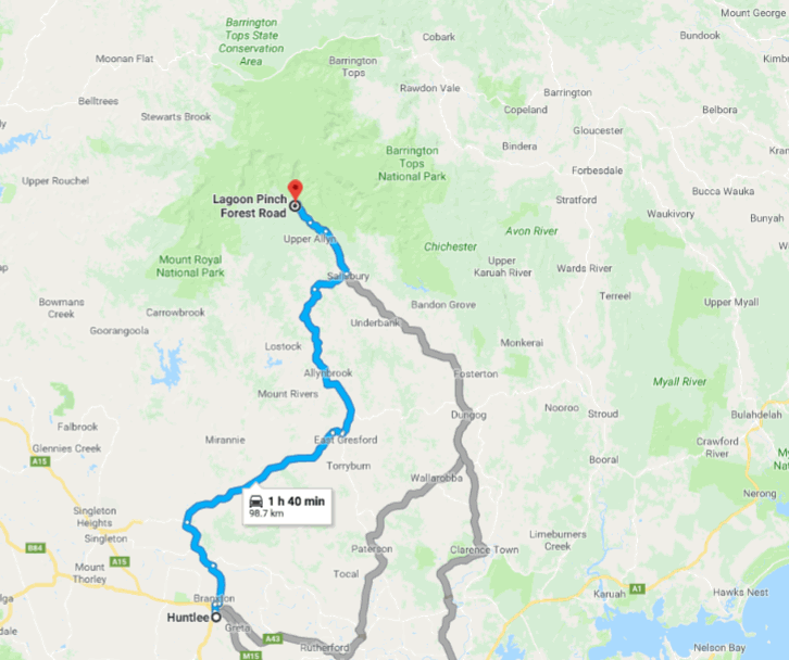
We woke up on Australia Day around 6.45am with the alarm-clock, had brekky, got ready and left Huntlee around 7.35am. Of course, we forgot the kiri cheese in the fridge but luckily we realised that after having driven for 5 minutes only and went back to Ben’s place to get it. Then we drove again around 7.45am towards Barrington Tops. I was driving and as I am a slow driver, it took a bit longer to get there, we arrived at 9.59am sharp at the start of the hike at the Lagoon Pinch Pic-Nic Area.
Some photos of the drive heading there:
")
")
")
")
")
")
")
")
")
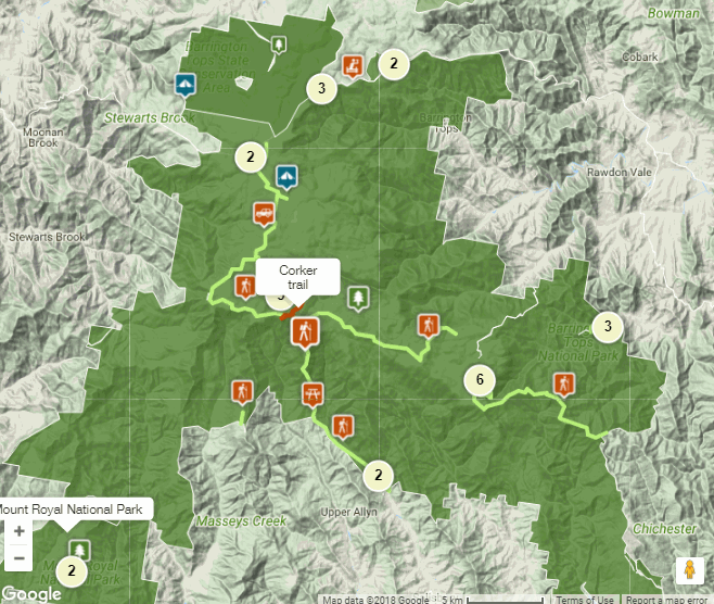
It was 10.25am when we started walking on the Corker Trail. Here is a page where you can find a bit more information about it:
https://www.nationalparks.nsw.gov.au/things-to-do/walking-tracks/corker-trail
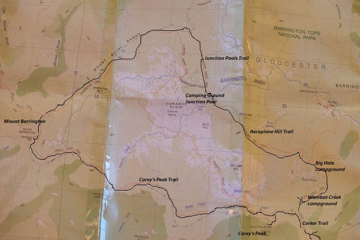
Here is the trail on the topographic map:

We had read a lot about this hike and knew that it was going to be a tough steep hike up on the first day so we were prepared mentally about that. At the beginning of the path, signs do warn about the fact it is going to be a ‘very very steep climb’. We also learnt about the phytophtora, the plant destroyer, which is a kind of tiny mushroom which infests plants all over the world and kills them. Yuk. https://en.wikipedia.org/wiki/Phytophthora
")
")
")
")
")
")
")
")
")
What I was less prepared even if we knew about it, was the heat. Especially at the start, hiking was not pleasant and we were very sweaty! It was really great to go up from 600m elevation to about 1,300 meters elevation, we did go through different forest types, sub-alpine snow gum woodlands, lush forest and Antarctic Beech. During the hike up, we only bumped into six people. First there was a couple which overtook us at some point and were going to the same campground. Then there was shortly after one older couple in their late fifties who had gone to Careys Peak lookout with day packs and were on their way back. And later on 2 young guys with day packs probably who overtook us, probably going late to Careys Peak and then going back down again. And that was it. We also had to clean our boots at a cleaning station because of the risk of carrying phytophtora around. It took us 6 hours (including a 30-min lunch break) to arrive at the campground. We had carried 5 litres of water each in case there would be no water in the creek, but there was plenty and we could have carried only 2-3 litres to drink for the day and that would have been enough. Oh well, better have more than less! so we got there around 4.30pm, pitched the tent, went for a wash at the creek, chilled and chatted to our neighbours, a friendly couple, Australian Luke and Emilia, Australian-Canadian from Vancouver who was a night photographer and showed us amazing shots she had taken on other camping trips. They were sleeping in hammocks and we spent some time talking camping gears, and admiring their setup. Their hammocks were from Ticket to The Moon and another brand I forgot, it sounded pretty cool. We then cooked dinner and fell asleep around 9-10pm. Camp life!
Here are some photos of our hike for the day:
")
")
")
")
")
")
")
")
")
")
")
")
")
")
")
")
")
")
")
Saturday 27th January 2018
We woke up, got ready, filled daily packs, made some tea, ate brekky, chatted to our neighbours, and then started walking around 10am to walk a massive loop in the National Park. We first went to the Carey’s Peak Lookout and then walked clockwise. I had roughly calculated based on online maps that the loop would be a 20km walk but it probably turned out to be more a 25-30km I think!
At the beginning of the walk, we saw a couple of crimson rosellas checking us out and some finch, and dragonflies. We passed the Carey’s hut built in 1934 at a time when some hoped that the Barrington Tops could be the Kosciusko of the North and offer a great ski resort in winter. The view at Carey’s Peak was pretty nice.
")
")
")

")
")
")
")
Here is an extract of a map about Barrington Tops telling about how it became a National Park:
‘Earlier this century, concern was expressed about the extensive clearing and degradation of the land in the Hunter area. 1914 saw growing support for the conservation of the scenic country in the Barrington Tops area. In 1924, a two week walking track was mapped out. Farmers and graziers were soon catering for the blossoming tourist trade, supplying horses, guides and food for the walkers. 1925 saw further agitation for a national park but there was opposition from commercial interests such as timber getters and summer grazing. A lengthy fight ensued until in 1959 the Gloucester Tops National Park of about 1200 ha was established. In 1969, the Barrington Tops National Park was declared, covering 16,325 ha including the existing park area. In 1984, an additional 22,380 hectares were added. ‘
We continued our walk and from Carey’s Peak Lookout to Junction Pool’s Campground, we saw no one at all. But we saw some great wildlife, two lyrebirds which disappeared very quickly, lots of lezards and wild flowers, some weird intestine dropped on the middle of the path, no idea why, we saw this several time. We had lunch at the Eremeran lookout from which we saw two yellow belly eagles but I was eating some wrap and by the time I was ready to take a picture, they were gone! The most exciting was to see two owls slowly after that lookout though. It was the first time I saw owls in Australia. I love the way they move their head in a 360 degree fashion.
")
")
")

")
")

")
")
")
")
")
")
We arrived at the Junction Pool campground which is 4WD access only (or walking) where there was a concentration of cars and people.
")
")
")
")
")
")
We continued our walk on the Aeroplane Hill trail, where we saw a sign listing all the airplane crashes which occurred in the Barrington Top National Park. One of them has remained a mystery, the crash of a small Cessna aircraft carrying the pilot and 5 guys. It still hasn’t been found! You can read more about it here:
http://www.theherald.com.au/story/4813431/36-years-later-still-no-trace-of-missing-aircraft/
")
")
")
")
")
")
")
")
")
")
")
In the evening, we kept hearing the yellow tail black cockatoos and saw a big batch of 16 of them flying above our heads. We got to the campground around 6pm, by that time I was literally limping! Too much walking for me, my leg was hurting below the knee. Emilia and Luke had left, gone pitching the hammocks near Carey’s Peak Lookout so they could watch the night sky better if the clouds kept out.
There was a group of 6 we bumped into who were going for a sunset view from Carey Peak lookout and had pitched the tents next to the toilets area. And then there was another group of 6 next to us from Newcastle, a guy Brendon with his friends, mum Se-ok from South Corea who had lived in Australia for more than 20 years and her husband Martin, Aussie from around, and their 3 daughters of 17-18 year old which turned out to be exchange students from Spain, Netherlands and Austria, while their own real 2 daughters of the same age were somewhere else, funny! They were a very friendly bunch with who we had dinner and chat, comparing our Back Country bags. Then Martin and Brandon lit up a fire in a matter of a second, we could tell they had a great experience. They had just gone walking the Overland Track in Tasmania between Christmas and New Year’s Eve and told us about the change of weather, freezing and snowy, even in the middle of summer but also about the beautiful landscapes there. Sounded great. We all went to bed around 10pm.
Sunday 28th January 2018
We woke up early and started getting ready, unpitching the tent, preparing brekky, putting on the boots and sunscreen. My leg was still hurting and Se-ok turned out to have been a nurse and rolled around my leg an awesome bandage in a professional manner, a way better one than the two bandage I had been carrying in my first aid kit for years! I decided that next thing I would do would be to upgrade for that bandage! Around 8.30am, the 8 of us started walking down together. We arrived back at the Lagoon Pinch Pic Nic Area car park around noon. During the hike back, Se-Ok spotted a tiny mushroom flower on the ground, very cute. Reminded me of the giant rafflesia one in Malaysia, but as a miniature version of it though. We also saw some natural benches, and enjoyed the beautiful wind in the leaves above us, and the great lookout again. At the end of the walk, Brandon found a leech which he took on his hand to show us quickly before it would bite.
")
")
")
")
")
")
")
")
")
")
")
")
")
")
")
")
Brandon, Martin, Se-Ok and their three girls stayed there to have lunch before heading for a long walk and swim afternoon in natural pools. We didn’t have much time left sadly as we knew the drive back to Sydney would be long but Martin told us about Williams River Pic Nic Area where to go for a swim, so we drove back to the entry of the park to that spot and stopped the car there. We swallowed quickly our last lunch, tortilla wraps, kiri and salami and then changed into swimming gears and walked down to the river. There we bumped into Emilia and Luke, which had just been swimming and were about to head back. It was really nice to swim and cool down after the sweaty hot hike. The water was cool but not cold, which made it really nice. We stayed a bit and then headed back.
")
")
")
")
")
")
")
We drove through Dungog and passed 4 pubs and 4 churches. That’s maybe what people do there over the week-end, plenty of socialising! Wake up. Go to church. Then go to pub. Then in the evening go to church again. Then pub. Go to bed. Repeat on Sunday.
")
")
")
")
")
")
")
")
")
")
")
Then we drove back all the way to Sydney. We noticed a very very long white pipe near the road and wondered what it was and discovered it is a water pipe, built a 100 years ago, which carries around water from the Chichester Dam. Interesting pipe repair story here: http://www.theherald.com.au/story/2023639/water-pipeline-15m-upgrade/
There was a bit of traffic on the way back which we managed to dodge in some sections thanks to google maps on the phone by exiting and taking smaller uncrowded prettier little roads but at some point we had to get back on the highway. We passed the Hawkesbury river and then drove and drove into Sydney, drove on the Harbour Bridge, filled the tank in Mascot and gave back the car at 7.10pm in Mascot. 10 minutes late, not too bad. It did take us 5h30 to drive back though!
")
")
")
")
")
")
")
")
We took train and ferry back and got home a bit before 9pm. It was a great camping week-end away and so nice to have discovered a little bit of the Mighty Barrington Tops National Park!
If you want to read more about it, here is a blog article I liked before to head there:
https://awildland.blogspot.com.au/2016/11/the-valley-of-thousand-fallen-trees.html?m=1
And some talks about the Corker Trail walk here:
http://bushwalk.com/forum/viewtopic.php?f=36&t=5859
